Climate and Cancer Map


Climate and Cancer map provides support for deciding where to focus cancer control efforts. Environmental factors are visualised and predicted to determine risks.I will be posting more detailed info and screens soon.
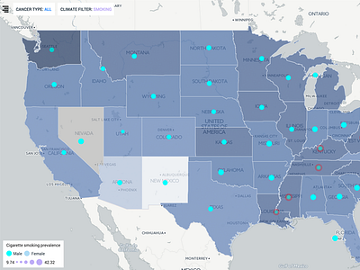
System provides thematical analysis and state cancer profile characteristics. Also , climate factors including criteria gases , toxic, precursors , lead , cigarette consuming and UV is visualised for each state and county level.
Pulsing points are indicating cancer level and climate levels are at the top risky point.


