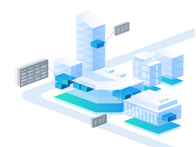
Geospatial

Inspirational designs, illustrations, and graphic elements from the world’s best designers.
Want more inspiration? Browse our search results...

  1. ASIO Logo Design 3d blockchain branding cloud collaboration crypto dashboard geospatial gradient heat map hosting icon identity it logo map saas software task manager tracking
    View ASIO Logo Design
    ASIO Logo Design
    589
    210k
  2. Land valuation tool acres ag tech analytics comparable sales crop history farmland farmland mapping farmland products farms geospatial geospatial analytics geospatial mapping land analytics land mapping land sales mapping ui design user experience user interface ux design
    View Land valuation tool
    Land valuation tool
    5
    1.2k
  3. Illustrations Set for Corporate Website branding corporate geo geospatial graphic design graphics illustration illustrations landing logo satellite website
    View Illustrations Set for Corporate Website
    Illustrations Set for Corporate Website
    2
    1.1k
  4. GIS People Presentation ai dark theme deck design geospatial gis google slides graphic design iconography icons keynote ml nlp pitch deck powerpoint presentation tech technology
    View GIS People Presentation
    GIS People Presentation
    3
    1.1k
  5. User Journeys Based on Experience Maps app experience geospatial journey product prototype sitemap ui user ux web wireframe
    View User Journeys Based on Experience Maps
    User Journeys Based on Experience Maps
    13
    3.8k
  6. Corporate system for organizing meetings and business trips analytic businesstrip cartography climate dashboard data geodata geospatial gis gisportal interactivemap maps meetingplanner mobile spatial ui ux weather webdesign webportal
    View Corporate system for organizing meetings and business trips
    Corporate system for organizing meetings and business trips
    4
    1.1k
  7. Geospatial Data in illustration: SafeGraph branding data geospatial illustration mono saas design saas website
    View Geospatial Data in illustration: SafeGraph
    Geospatial Data in illustration: SafeGraph
    23
    4.1k
  8. Uber Movement for New Mobility | Card Interaction card ui data data design data viz geospatial gif map viz uber uber design ui design
    View Uber Movement for New Mobility | Card Interaction
    Uber Movement for New Mobility | Card Interaction
    599
    144k
  9. iSpatial Web App geospatial map ui ux
    View iSpatial Web App
    iSpatial Web App
    7
    1k
  10. MongoDB Compass, Geo Query Schema Visualization compass geospatial map mongodb
    View MongoDB Compass, Geo Query Schema Visualization
    MongoDB Compass, Geo Query Schema Visualization
    26
    7.1k
  11. Globe Mobile add app data esri geo mapping geospatial layers mobile queensland ui ux
    View Globe Mobile
    Globe Mobile
    19
    5.1k
  12. Geospatial Data Viewer animation cropping design framer geospatial interaction map mapbox mobile motion
    View Geospatial Data Viewer
    Geospatial Data Viewer
    61
    9.6k
  13. Shipment tracking dashboard analytics dashboard dashboard data viz geospatial geospatial visualization globe map order tracker product design shipment tracker shopify shopify app track shipments tracker tracking tracktor ui ui design visualization
    View Shipment tracking dashboard
    Shipment tracking dashboard
    111
    35.7k
  14. Versio Version Explorer for Geospatial Data compare comparison data flat flat color geospatial gis history map spatial timeline ui
    View Versio Version Explorer for Geospatial Data
    Versio Version Explorer for Geospatial Data
    20
    7.1k
  15. NextNav Mobile Incident Response Management 3d altitude android geospatial groups incident response ios map mapping mobile teams tracking
    View NextNav Mobile Incident Response Management
    NextNav Mobile Incident Response Management
    56
    14.2k
  16. Uber Movement Speeds app data data visualization dataviz geospatial gif speeds uber ui
    View Uber Movement Speeds
    Uber Movement Speeds
    12
    3.8k
  17. Geospatial blue earth ebusiness elearning featured geospatial icons menu nav
    View Geospatial
    Geospatial
    24
    2.2k
  18. Open Source GIS earth science geospatial gis nasa open source scaling systems software
    View Open Source GIS
    Open Source GIS
    27
    3.8k
  19. Morgan Geospatial - Brand Design brand branding business clean corporate drone geospatial logo minimal monogram simplistic vector
    View Morgan Geospatial - Brand Design
    Morgan Geospatial - Brand Design
    17
    2k
  20. New Career at CartoDB adventure career cartodb cartography geospatial join map maps opportunity tell stories thanks
    View New Career at CartoDB
    New Career at CartoDB
    19
    2.1k
  21. Geo Spatial Visualization website branding geospatial hero landingpage maps ui ui design uiux website
    View Geo Spatial Visualization website
    Geo Spatial Visualization website
    17
    2.7k
  22. Boundless color earth flat geospatial illustration opensource space website
    View Boundless
    Boundless
    11
    1.1k
  23. Howard - Planning Policy Information Service data data vis geospatial information architecture information design london mapping responsive search ui ux web app
    View Howard - Planning Policy Information Service
    Howard - Planning Policy Information Service
    10
    3.7k
  24. Connecting brands with clients brands geospatial map promotion
    View Connecting brands with clients
    Connecting brands with clients
    23
    1.9k
Loading more…